

Golden TriangleChiang Rai, Thailand’s most northern province, is almost 800 km from Bangkok. The northern border of the province separates Thailand from both Laos and Myanmar. The Mae Mok River, flowing for over over 130 km is the major river that cuts through the rugged mountainous topography of the region. The mountains in turn being home to nearly a dozen different hilltribes that have migrated from such places as Tibet, South China and Burma.
The mountains and jungles, with their abundance of flora and fauna, are a perfect place for nature lovers and adventurers alike. The many flowing rivers offer an exciting way to pass through the natural beauty of the landscape.
The city of Chiang Rai was founded in 1262 by King Mengrai, who later moved the capital of his Lanna Kingdom from Chiang Saen to Chiang Rai. It was the capital for a brief time before threats of invasion led to the laying of the foundations of Chiang Mai, which would eventually replace Chiang Rai as the capital of the Lanna Kingdom. Later, in 1786, when King Ramatobodi (Rama I) was consolidating the country after the destruction of Ayutthaya, it became part of Thai territory and was later proclaimed a province in 1910 by King Rama VI.
Places of Attraction
Monument of King Mengrai the Great
This monument is situated just off Phahonyothin Road, at the eastern edge of town, in honour of the illustrious king who founded Chiang Rai in 1262.
Ku Phra Chao Mengrai
The home to the ashes and the relics of King Mengrai, the stupa is situated in Wat Ngam Muang, which is perched on top of a small hill overlooking the town and countryside.
Wat Phra Singh
This teaching monastery, dating from 1385, is located on Singhaklai Rd to the north of town. The temple buildings are wooden and built in the typical northern style. The main viharn holds a reproduction of Chiang Mai’s Phra Singh Buddha, a Buddha image from the Sukhothai period. There is also a stone Buddha footprint inscribed with Khmer script, said to date from during the reign of King Mengrai.
Wat Phra Kaew
This is the city’s most revered Buddhist temple. The date of its founding is unknown, but was probably in the 14th century when it was known as Wat Paa Yai. There is a legend that says the octagonal stupa was struck by lightning in 1434, revealing the famous Emerald Buddha (now housed in Bangkok’s Temple of the Emerald Buddha). In 1990 a replica of the image was commissioned to be sculptured. A Chinese artist carved the almost exact replica from Canadian jade and it now sits in Phra Kaeo Shrine behind the bot.
Mae Sai
Mae Sai, the most northerly point of Thai territory, sits on the banks of the River Sai opposite the Burmese town of Tachilek. Its position has made it a bustling market place with a wide range of Burmese and Thai jewellery, handicrafts and other goods hawked around the main road. Accommodation in Mae Sai is quite comfortable, with pleasant riverside guesthouses or mid-range hotels to choose from. For visitors wishing to travel further into Myanmar, travel is now possible.
Wat Phrathat Doi Wao
Set on the hill to the west of town, it was supposedly built in memory of thousands of Burmese soldiers killed during fighting with the KMT here in 1965. The temple offers superb views over Mae Sai and Myanmar.
Thanam Luang (Great Cave)
This impressive cave is located about 6 km from Mae Sai, just off Route 110 to Chiang Mai. The huge cave has a series of chambers and tunnels that lead for kilometeres into the hills. Gas lanterns and guides can be hired at the entrance and are recommended.
Wat Phrathat Doi Tung
The village can be reached by taking Route 110, 22 km south from Mae Sai to Huai Klai. Then take Route 1149 along an interesting background of hill-tribe villages and former poppy fields for 24 km to reach the temple located in this hill-top village.
Doi Tung (Flag Peak) inherited its name in the early 10th century, when King Achutarat ordered a large flag to be flown above the peak. The flag was to mark the spot of the two chedis that still exist there. The Lanna-style chedis, erected in 911 AD, are in the compound of Phra That Doi Thung and are said to contain the left collar-bone of Buddha. They were renovated earlier this century by a monk from Chiang Mai, Khruba Siwichai. The temple’s compound is home to a vast array of Buddha images from all periods of Thai history in their distinct and various styles. One of the most interesting is the large Chinese-style Buddha image with its large belly having an opening in the navel. Many people line up to throw their good-luck charms into the navel, wishing for good luck to fall upon themselves and their families. The temple walls offer a perfect vista of the long meandering road leading to the hill top and the surrounding countryside.
Chiang Saen
The town of Chiang Saen was once the ancient capital of the Chiang Saen Kingdom. It was established in 1328 by King Saen Phu, the grandson of King Mengrai. It was later captured by the Burmese in the 16th century, before being recaptured by King Rama I in 1803. The town was then destroyed to ensure it was not used in future attacks by the Burmese. The town then remained almost deserted until King Mongkut ordered it to be re-populated in the late 19th Century.
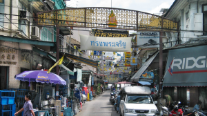
These days Chiang Saen is a quiet little town, with its architectural remnants devoid of the attention of many tourists, but very much still there in evidence.
Wat Phrathat Chedi Luang
The temple was built in 1331 by King Saen Phu and was established as the city’s main monastery. Further extensions were added in 1515. Laying amongst the ruins are an octagonal Lanna-style chedi, standing 58 m high.
National Museum
This small museum contains many artefacts from the Lanna period, including Buddha images with distinct rounded faces and slender bodies. The museum also houses a small display of handicrafts from hill tribes, including clothing and musical instruments.
Wat Pa Sak
The unusual chedi is the main attraction in Chaeng Saen, built in an interesting variety of styles – blending Pagan, Dvaravati, Sukhothai and Srivajayan influences. The temple was founded during the reign of King Ramkamhaeng in 1295.
Wat Phrathat Chom Kitti
About 2.5 km north of Wat Pa Sak, lies this temple which is said to date from the 10th century. The temple, which is approached by 383 laterite steps, offers a splendid view over the surrounding area.
Wat Phrathat Pha Ngao
This restored temple sits on a hilltop, overlooking the river, about 4 km south of town. Enshrined in the temple is the large bust of a brick and plaster image. Located on the hill is a modern chedi that enshrines a Buddha image that was found buried in the ground in 1976.
Sop Ruak
This small village, set at the junction of the borders of Thailand, Laos and Myanmar, is more generally known as ‘The Golden Triangle’. The name is associated with the opium trade that once flourished in this region. But with the intervention of the Thai government, the narcotic is no longer the economic mainstay of the area. Instead the locals now facilitate the intrigue of the flocks of tourists coming to sense the atmosphere of what was once one of the major opium producing regions of the world. The streets are littered with stalls, selling a range of Thai, Lao and Burmese clothing and handicrafts and a few restaurants to cater for the bus loads of tourists.
Opium Museum
This small museum has a display of implements relating to the narcotic. There are the tools used for planting, harvesting and for smoking the drug, along with weighing scales. There also old photographs and maps of the poppy plantations.
CHIANG KHONG
This small riverside town was once part of a small state called Juon, which over the centuries came under control of Chiang Rai, Chiang Saen and finally Nan before being incorporated into the Siamese nation in the late 19th century.
Its territory once stretched as far Yunnan in southern China, until French colonialists converted most of the eastern lands of the Mekong River into French Indochina in 1893.
Nowadays the town is a crossing point to the Lao city of Huay Xia. Trading, whether it be legal or illegal, is the major activity here. The markets busily dealing in the wares of both sides of the river. About a kilometer south is the village of Ban Hat Khrai, famous for its plaa beuk (giant catfish), a delicacy and the largest fresh-water fish in the world.
MAE SALONG
Often called Thailand’s ‘Little Switzerland’ the village of Mae Salong sits at an altitude of over 1200m, near to the border with Myanmar. Its setting on the mountain peak not only gives fantastic views over the region, but it can also be quite mystical when the mists surround it.
It was originally populated with a rebel KMT(Kuomintan) army regiment that initially fled to Burma, after the communists forces took control in the 1949 Chinese revolution. After being dispelled from Myanmar in 1961, they were allowed the freedom to settle in this northern village, where they helped the government against communist infiltration. The community prospered and enlarged, taking up agriculture and farming and future generations taking up Thai citizenship.


Add Comment